Monroe and Jefferson is an odd combination because it bypasses Washington peak which is in between and just skirts it at about 4500 - 5000 ft. I had failed to claim Monroe when I did Washington, even though it would have only added 1 - 1.5 hrs from Lake of the clouds Hut. Somehow I never wrote a trip report or I lost it, so the following is bit sketchy.
This hike was up Ammonoosac trail again (same as when I did Washington). From AMC guide-on-line the total distance is 13.22 miles, elevation gain 5,270 ft, and book time 9:13. I don't have my exact times but I did write down that it was 15 hours, starting an hour before sunup and getting back in way past sunset. There were however many stops, a few actually for work trying to schedule an upcoming trip where I had to stop to keep connectivity.
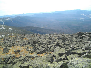
From Lake of the Clouds Hut (still closed) at the top of Ammonoosac, I did a quick up and down of Monroe. Some pretty deep snow on the South face. I then then took Crawford path, Westside trail and Gulfside over to Jefferson. Westside passes under the Cog rail trestles. Westside and parts of Gulfside are near horizontal trails hugging contour across the west side of Washington and feel like your walking across the top of a neatly stacked New England stone wall, except that if you fell off on the low side you would keep rolling down the mountain for hundreds of feet. Approaching the Jefferson loop you pass through a level grassy area (sedge) appropriately named Monticello lawn and start ascending what to me seemed like an endless number of false peaks up piles of huge boulders. The wind had picked up considerably by the time I got to the actual peak so I snapped a few pics and quickly (for me) headed back to Gulfside and down the Jewel trail which starts just to the North of were Gulfside crosses the railway. BTW, once again I had cheated and had stashed my pack and most of my gear at the top of the Jewel trail when I was heading toward Jefferson. I found going down the Jewel a bit tedious and unchallenged and it seemed to go on forever. Between the Jewel and Ammonoosac, the Jewel would be a much easier (but probably longer) approach to Washington, However Ammonoosac is much more interesting and scenic with its water crossings and steeper climbs.
Pictures:
Still a lot of ice on the Ammo.
Crossing that I had a hard time with
coming down Washington was an easy rock hop.
View of Washington from Lonesome Lake Hut.
View back at the hut while going up Monroe
False peak of Monroe
Some kind of geological marker?
or what is left of one.
Guess this my Monroe summit pic #12
with Washington in background.
I think this was the actual Monroe peak.
Looking North to Washington from Monroe
heading toward Washington on Crawford Path.
New England stone wall skirting around Washington.
Yellow rock is a blaze.
This is were you would fall if you stepped off the wall
View of multiple peaks of Jefferson.
The furthest away is the actual peak.
The furthest away is the actual peak.
Cog railway trestle -
I picked up a hunk of souvenir coal.
I read about these. This is a smooth bowl like depression
caused by years (100s) of a small rock being blown
around in a small crevice after the glacial melt. Or something like that.
Montecellos' lawn approaching Jefferson
first false peak
wind picking up.
looking across into the Great Gulf
Ravine on north side of Washington
#13 Jefferson - Windy
memorial plaque near the top.
large cylindrical cairn just below the peak.
I've seen pictures where this went much higher into a cone.
Vegetation picking up on the way back.
Looking down Jewel trail before getting into the wooded area.
GO BACK TO THE INDEX.
GO TO THE NEXT HIKE
GO TO THE PREVIOUS HIKE


