Carter Dome, Middle Carter & Wildcat "A" March 2017
Carter Dome, Middle Carter & Wildcat "A" March 2017
#'s 39, 40, 41 of my Winter New Hampshire 4,000 footers (7 to go)
First and only winter hike this season. I have a temporary transportation problem but I was able to do this 5 day trip completely by bus from Providence Rhode Island to Pinkham Notch N. H. Once a day there is a Concord Coach Line bus that runs from Berlin New Hampshire to South Station Boston and return, with stops at the AMC Pinkham Notch Visitor Center (PNVC) . A perfect place to start off hikes to the Wildcats , the Carters, or especially Mt Washington (maybe next time). My perfect plan was;
Day1: Catch a bus from home or providence RI, bus up to Pinkham Notch (PN) (leaves Boston at 4:15pm arrives at PN 8:15pm) and spend the first night at the AMC Joe Dodge Lodge at PN (unfortunately I would arrive too late for the included diner.)
Day 2; Catch the Breakfast buffet at 0630, road hike 4-5 miles down Rt 16 to Nineteen Mile Brook Trail head. Hike the 19 Mile Brook trail 3.8 miles (1991' elevation gain) up to the Carter Notch Hut, and spend the night at the Hut.
Day 3: Leaving much of my gear (weight) at the hut, hike from the hut to Carter Dome, S Carter and Middle Carter (three 4ks) along the Carter-Moriah trail and back to the hut (total of 9.2 miles and 3760' elevation gain/loss), This day of course had options to turn back after the first or second peak.
Spend that night at the hut.
Spend that night at the hut.
Day 4: Pack up all my gear and hike from the hut up to Wildcat ("A") over to wild cat "D" along the Wildcat Ridge Trail (1700' elevation gain, 950' loss). only A and D are 4k peaks but I would have to go over B & C with many PUDS (pointless up and downs). Then down the wildcat polecat ski trail ending up very close to PNVC in time for diner at PNVC and spend that night at JD lodge.
Finally Day 5: Up early grab the included breakfast buffet , catch the bus to Boston 8:15, hopefully arriving in Boston on time at 12:20 and catching the 12:30 Peter Pan bus to providence where my wife may pick me up or I can catch a Rhode Island bus almost to my door in Portsmouth RI.
At least that was the plan. I ended up doing 3 of the 5 peaks I wanted but for the most part stuck to the plan as far as buses and lodging go. I had to turn back at S. Carter skipping M. Carter because the trail to Middle wasn't broken out and I was already exhausted. on Day 4 I realized that I wasn't up to hiking up to Wildcat A and going over the ridge with my full pack and overnight gear, so I left my pack and most of my gear at the hut and slack packed up only to Wildcat A with two belly packs and returned to the hut for my gear then hiked back down Nineteen Mile Brook Trail. I'm also thinking that I may want to leave Wildcat "D" for a short 1 day hike next winter where I hike up carrying skis and boots and ski down.


Nineteen mile Brook trail head. BTW the clock on my camera is about half an hour behind. this was about 7:30.


Interesting snow drifts.

close to the hut the trail became really undefined.

At the hut. The view looking up toward Carter Dome from the bunk house I was in.

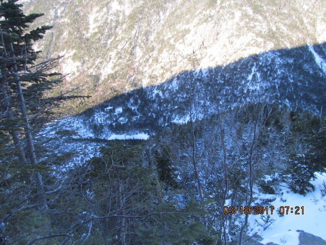
Looking toward the Wildcats


Friday night I had a full 4 man bunk room to myself. There were only ~ 17 guest that night. Full capacity of the CN Hut is 40; two bunk houses with two 4 man and two six man bunk rooms each - I think.).


Great views with zero wind on the top. This would have been a good day to do Washington.

I think that next peak you see here is S. Carter, but it might be Mt Hight hiding S. Carter.

Another selfie with better background

The story is; coming off Carter Dome, typically people go a little further to go over Mt Hight rather around it because of the great views on Hight and also you don't have to walk cross slope on the Carter Moriah (C-M) trail that bypass Hight. However there was really only one set of tracks off the north of Carter Dome and no sign of any broken out trail over Hight. That section of the C-M on the side slope of Hight was hell, with only one set of snowshoe tracks on soft snow. It was a hard slog getting though it and down to zeta pass where the C-M trail which continues along the ridge meets the carter Dome trail which goes down and joins nineteen mile trail (maybe I'll post a map here later) . Actually when I got to Zeta pass the C-M trail up to S. Carter wasn't broken out, but 5 people coming up behind me from the Dome passed and continued on breaking the trail. With a larger group of hikers its easier to break trail because you rotate the point man in shifts. I ended up way behind the group and just blindly followed the path they were making. It turned out that they had lost the actual trail and were just meandering off in the wrong direction. They realized it the same time as I did and were backtracking to try and find the blazes on the actual trail (The Carter-Moriah is part of the Appalachian trail and should be well blazed with white blazes (paint swaths on the trees). I checked my GPS against a saved track and realized we were quite a bit off of the trail. I bushwhacked to where I thought the trail should be while the others backtracked and found their error. We both ended back on the actual trail. By this time I was really exhausted and had a pretty hard time getting up the steeper sections to S. Carter. The trail wasn't broken out from South to Middle Carter, but even if it was I still would have turned around at that point. I think there was one couple that did continue on.


Per my GPS started today's hike at 6:31am and returned to the hut at 6:52 pm,only 8.2 miles in 12 hrs 20 minutes. That may be a slow record for me. Slow hiking but also hundreds of 30 second stops to catch my breath. GPS says that only 6 hrs of the 12 hrs was moving time. I was having a hard time of it that day particularly after reaching the Dome. I think I had slipped back into AFIB near the beginning of this hike. (I was electro cardiaversion (zapped) back into normal rhythm 6 months ago). that combined with my emphysema made it a real tough day - but worth it.
When I got back to the hut it was pretty much at full capacity with 36 guest. including a few boys scout troops. I had two new bunk mates but never actually met them. I saw there gear when I returned to the bunk room then went down to the main hut to fix dinner and get some warmth and when I returned they were both asleep in their bags. Then I left for my last day hike before they were up.
Day 4:
I woke up feeling much better than the night before, but as I mentioned before still thought doing all the wildcats with a full pack would be too hard for me. (going up to A is also fairly steep) so I just packed two belly packs with water, snacks and my crampons and "slack packed" up to wild cat "A". it was also very overcast with just a light snow when I started. From the following you can see that I hit the peak in the fog with no views.


Hiking out on nineteen mile brook after retrieving my gear from the hut. I had my belly pack on upside down and couldn't get to my camera without taking off the pack, so no pictures until all the way back down nineteen mile when I took a break and removed my pack.


They sell 2'x3' 3-d plastic map. I wanted one but it would have been hard to carry it on and off the bus with all my gear.


On the bus. It was only 10 minutes late , but I was getting worried.- Only one bus back all day.
It was a great 4 night trip , not having the long drive in traffic up and back from NH. The buses are actually pretty comfortable. Even though its the end of the official winter peak season, I may just try and do a another bust trip and do mt Washington before the snow's gone. Ive never hiked Washington from the east side. Otherwise my next trip north will probably be to do trail work on Black Pond trail.
posted by 1SlowHiker @ 8:07 PM
0 Comments
![]()
