#40 Cabot 12-6-12
12-06-12 Cabot, Bulge, Horn, Loop: (Mt Cabot 4150' - 40/48 NH4K), (The Bulge 3950' - 41/100 NEHH) , (The Horn 3905' - 42/100 NEHH)
Trip Stats: 11.5 miles,
trail head alt 1720’, elevation
gain/loss 3580’, AMC book time 7:30,
Start: 05:20 (1 hr before
sunrise) , finish 16:20, hike time: 11 hrs , Breaks time: 1:00, hiking time: 10:00, Ratio to book time: 1.37 ( a bit over my average of 1.3)
TRAILS: I did this loop clockwise. York pond Trailhead to Bunnel Notch trail to Kilkenny trail to the old Cabot Fire warden ‘s Cabin ( now used by hikers and maintained by a scout troop), to Mt Cabot (viewless 4000 ft), to The Bulge (a viewless 3950’ mt. on the New England Hundred Highest (NEHH) list , to the Horn spur off of Kilkenny Ridge trail) , to The Horn (also a NEHH, with fantastic views from a difficult peak of boulders), continued on Kilkenny Ridge to the junction with unknown pond trail, past unknown pond and the campsites there, to the Unknown pond Trail trailhead , short (.2 mile) road hike back to my truck at the York Pond trailhead

Hike Map from AMC Guide On-Line

GPS Track. C6= Cabin, C7=Mt Cabot, C10=The Horn

elevation profile

05:30 start at York pond trail head past the fish hatchery on York Pond Rd
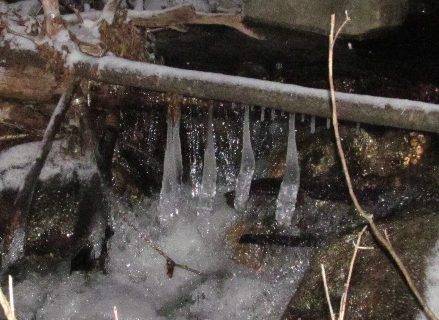
ice sculpture - hanging Christmas stockings


This is the moon not the sun.

Lower trail is like a river.

Just enough snow to hide ice patches.

Further up parts of the trail are just ice flows.

I knew there was a cabin near the top but was surprised
to find a working, well maintained, compost outhouse
(flush with handfuls of supplied shredded bark)


I took a 20 minute break to eat, rest and make use of the outhouse.

I think this is from the opening on the trail near the Cabot summit.

#40/484K ! This is the actual Mt Cabot summit - marked by a strip of wood screwed into a tree. I was really tempted to head back down the way I came. I was really cold at this point. I had left my gloves off too long at the cabin and my fingers were taking their time warming back up. As it turns out I'm really glad I continued on the loop. The next two peaks, The Bulge and The Horn, are under 4000 ft and aren't on my list of 48NH4K's, but are on the New England Hundred Highest (NEHH). I had planned to do the full loop just in case I ever decide to attack that list. Unlikely, in that most of the Maine NEHH are really a long drive.

The Bulge is just a high point along the Kilkenny trail going north from Cabot. No real views, but it is my first NEHH under 4000 ft.

#41/ 100 NEHH

Ice Sculpture - a Knight (chess piece)?

A lot of Blow-downs across the trail north of Cabot
this one is too low to go under and too high to go over.


Trail junction for the spur to The Horn. I dropped my pack here and just took, what I call my bug-out pack, to The Horn, It's really an EMS fire jumpers fanny pack. I carry all my emergency supplies in it (first-aid, compass, maps, batteries, flashlight, water treatment..) it fits perfectly in the lower compartment of my larger pack .


The last short section to The Horn is a scramble and the only really technically tough part of the hike. The peak itself is several huge boulders with no easy access. I attacked it from the northeast side which I think is the easiest but doesn't look like its well used.

Those 2 little trees are at the actual summit. Someone more capable than me may be able to get up from this approach using that crack for finger holds, but I squeezed my way between the boulder and some trees on the left for an easier approach.


The Horn #42/100 NEHH. The Horn his is going right near the top of my favorite peaks, even though its under 4,000 ft. You have fantastic 360 degree views, and probably not the crowds you would get at some of the 4k peaks on clear days. Somehow it seems better because you have to work a bit harder to get to the very top.


Cabot and the Bulge

Looking South to the Presidents.

Zoomed in - Mt Washington on the right.

Looking down from the peak, I squeezed between the boulder
and those trees to come up from the right.

Looking North I think


York Pond?


Back at the Horn Spur junction with Kilkenny Ridge trail. When I got back here, I saw tracks of 2 people hiking South on the trail toward Cabot that must have passed me while I was up at the Horn. I'm surprised they passed on the Horn. The tracks continued until Unknown Pond and came in handy for finding ways around some thin ice sections on the trail.

Another tough blow-down to get around
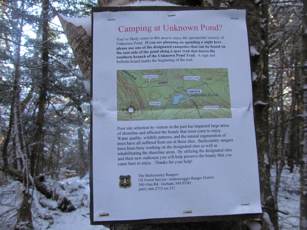
Camping sign near Unknown Pond

Unknown Pond.

?? What are these prints from? They look like a little persons feet, maybe some kind of rodent, but there is no trail to them so it must be something that flies, but they don't look like any kind of bird track. Bats Maybe?? I saw more of these later and always just two prints with no sign of walking.

There was more snow on the north side of Cabot then coming up. I wore micro-spikes from Cabot just to this point a little past the campsites at Unknown pond. This was a tough marshy area to cross and I stepped in the wrong spot and went down to my ankle in mud pulling one micro spike off as iIpulled my foot out.

Gator-Aid slushy - Brain freeze!, I had to dig deeper in my pack for warmer water.

Bird crossing the trail. Going up to Cabot, there was a trail of tracks like these for almost a hundred feet of the trail. some kind of bird that doesn't like to fly much. Quail? Spruce Grouse?

Thickest trunk I have ever seen on a Birch tree
(see the hiking pole for size reference)

A particularly tough water crossing ....

I ended up side stepping across this thin log, that would never hold my full weight, by putting as much weight on my trekking poles as possible.

Picture is not good , but these are paw prints that look like a small dog, but no human tracks around and still over an hour away from the trail head. Fox maybe?


I came out at the Unknown trail trailhead a short distance back on York pond Rd from were I started.

Back at the York Pond trail trailhead about 1630 - before dark :) .
A great hike but I wasn't looking forward to the long drive home.
GO BACK TO THE INDEX.
GO TO THE NEXT HIKE(whiteface/Passaconaway)
GO TO THE PREVIOUS HIKE (Carrigain)
posted by 1SlowHiker @ 6:00 AM
1 Comments
![]()
