#27: Mt Tecumseh, Oct 2, 2012
#27 Mt. Tecumseh (4003'), October 2, 2012
This was the shortest and easiest hike yet. Kris (my 12 yo gradson) and I were going to do it from Tripoli Road a week earlier, but we decided to do the Osceola’s instead. This hike was kind of on the spur of the moment and I couldnt arrange it for Kris to join me.
This is the trip report I submitted to VFTT:
Date of Hike: Tuesday 10/02/12
Trails: Up Tecumseh from Waterville Valley side, Sosman trail to top of ski area, down ski slopes (intermediate slopes - no diamonds). Trails where wet and damp but not much mud or standing water. Fresh cover of wet new fallen leaves - but not really slippery. Yellow blazes was more than adequate for following trail where leaves had covered it. Ski slopes were damp with some running water down them and a bit slippery in higher grass spots. Special equipment required: adjustable trekking poles were a big help for me coming down the slopes. Think i could haved used micro spikes on some of the steeper slippery grassy ski slopes.
Comments: Weather and foliage couldn't have been better. Fantastic panaramic views of foliage and mountains all the way down. Wasn't sure about my choice to take the slopes down but it was worth the views and was faster and probably a bit easier on my knees then trekking down the long stone staircase. Half a dozen turkeys kept scurrying by me on the way down. Shortest and easiest 4k I've done yet.
As reported above it was an easy hike up with great foliage where the trail had a spur to the ski slopes on the way up (see pics). Up until the junction of going left or right to the summit (see pics) it was kind of a steady stair-master hike up. At the junction, I went left and came back the other way contuing clockwise ). Left is probably a bit easier. After peak bagging and taking a few pics, another hiker came up from the other way. I discussed the possibility of taking the Sosman trail to the top of the ski slopes and going down thev slopes. He evidently had done that on other mountains and advised against it. However, when I got to the junction, I couldn’t resist and cut off to the top of the slope along the Sosman trail. It was longer than I expected and went down quite a bit then back up before I got to the top of the slopes. It turns out it was a great choice because all the way down the ski slopes, I had great views of the mountains east of me and the magnificent foliage of the valley in between. (see pics). I had to zigzag (slalom) down some of the steeper slopes and for some reason, though this was my easiest hike yet, my upper thighs felt like spikes had been driven into them for the next 2-3 day. Overall, a great quick hike where I spent more time driving then hiking.

Tecumseh trailhead on North end of
Waterville Valey Ski parking area.

start of the trail - easy grade which continued most of the hike.

views from the ski slope from a short spur off the trail.


Trail get slightley steeper but wider.
I believe this is an old logging road.

nice mossey, lichen are on the trail

Decisions Decisions -
I went left and came back the other way.

Above the summit signs, the trail finally gets a little more agressive -
but still easy

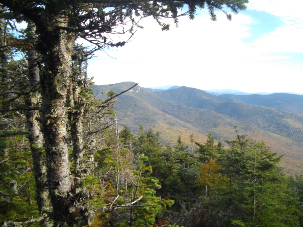
At the summit.


Top of Waterville Ski slope where the Sosman trail ends.

Eastern views coming down.
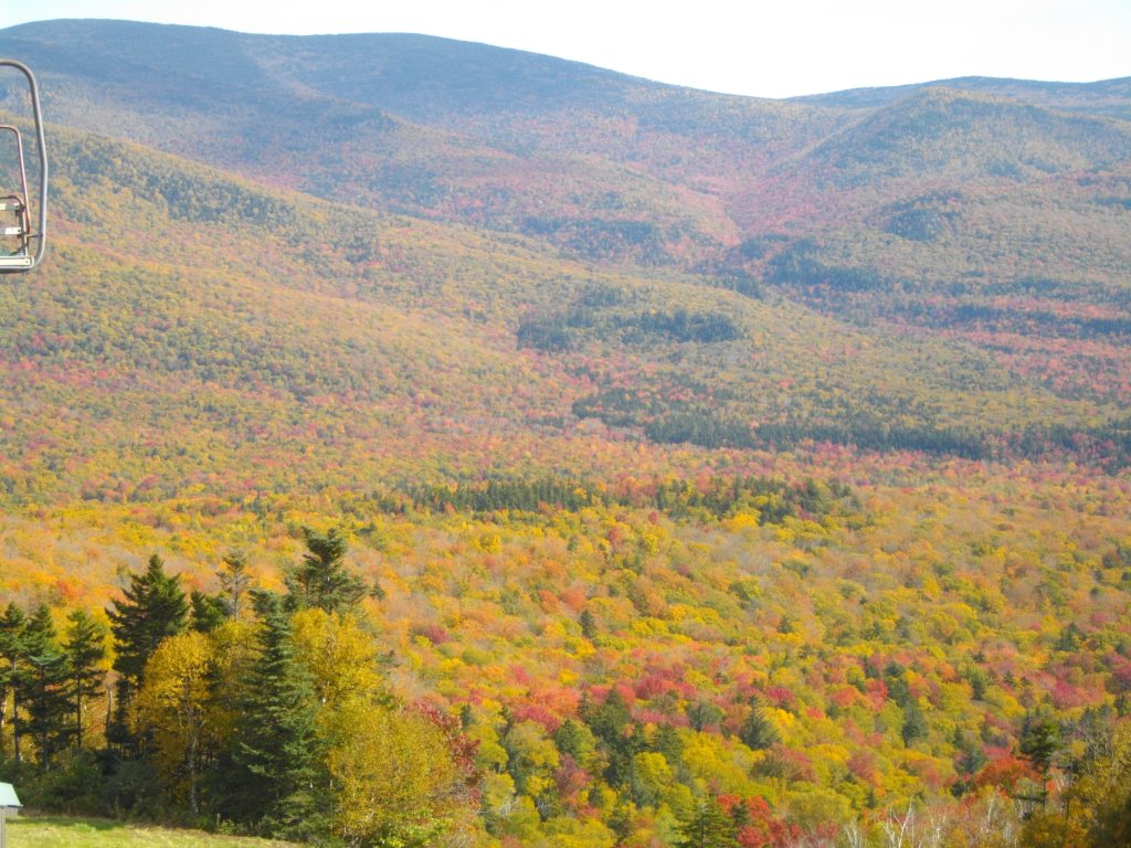
More eastern views coming down.
Camera did not catch the magnificants and variation of colorsd.

An interesting mountain top on the ride back 49 to 93,
Welch? Dickey? Cone? Anyone know? Have to put it on my post-48 Mt list.
GO BACK TO THE INDEX.
GO TO THE NEXT HIKE
GO TO THE PREVIOUS HIKE
:
posted by 1SlowHiker @ 10:47 AM
0 Comments
![]()
