Saturday, November 12, 2016

Black Pond Trail Maintenance

Winter New Hampshire 4K (NH4K)Hikes,   New England Hundred Highest (NEHH) list,Maine/Vermont 4K Hikes,   New Hampshire 4K Hikes

Black Pond Trail Maintenance  Fall 2016  -  11/12/16 posted 3/25/17

At the end of last year I volunteered  to adopt this short trail. Black Pond Trail is often used in the winter to start a bushwhack approach to Owls Head and starts off of Lincoln Woods trail. Black Pond trail is only 0.8 miles each way but 2.6 miles in on Lincoln woods. So its  only 5.2 miles round trip to the pond.   I drove up to NH and did the required one day training, then last October went up and did some pre-winter season trail maintenance. Mostly trimming brush that was starting to grow into the trail and sawing up and moving blow downs - a few good size ones.  Below are some photos from that trip.
 I brought some of my own tools and picked up a few from a cache in Lincoln that trail keepers can borrow. The golf cart was my wife's ingenious idea and worked pretty good, at least for on Lincoln Woods and about half way on black pond trail.


 A section of the old track. Lincoln woods trail used to be a railroad track bed.


 Lincoln Woods is a wide straight trail. Well used by locals for walking dogs and cross country skiing in the winter.

 Large Birch blow-down across LW trail. You can see a few of the RR ties here too.

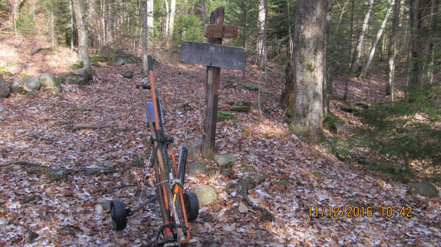
 Here she is - the start of Black Pond Trail.

 My first blow down to clear.
 Piece of cake , it was pretty rotted.
 At Black Pond.  Go to Owls Head  to see it frozen with an igloo on it.
 More blow-downs.  I left quit a few on the way in to hit on the a way back .

 This was the biggest one I cleared just before the pond. needs two cuts but the first one wore me out so I went on to a few smaller ones before tackling the second cut.


  This is the big one again after I made the second cut and rolled it aside. I was pretty proud of myself on this one.  If there are blow-downs too big to handle we are suppose to notify the rangers and they will contact someone to come in with a chain saw.

 There were two high blow-downs. I think this is the one I could actually get at.
 The next high one down the trail is the one I had to leave. It shouldn't be a problem for winter snowshoers unless there is reaally a lot of snow this winter.  If its still there I may tackle it in the spring.


Back on Lincoln Woods trail. I made a half ass try at cutting through this but didn't get far (not my trail though).  I reported it to the rangers at the LW trail-head They said it must have just come down because it wasn't there the day before and that they would contact a team to take care of it.

Think I did a pretty good job today.  Not a big or  hard trail, but at least I'm giving a little back.  Makes me really appreciate the volunteers clearing the  harder mountain trails. 

 I'll come back after the spring thaw and make another pass. There is a few blazes that probably need a little new paint.

Winter New Hampshire 4K (NH4K)Hikes,   New England Hundred Highest (NEHH) list,Maine/Vermont 4K Hikes,   New Hampshire 4K Hikes


Wednesday, March 16, 2016

Mt Adams March 16th 2016

Mt Adams 38/48 NH4KW  

Last official Winter hike of the season (10 NH4K winter peaks left for next winter -  or the next). I had originally planned to try and finish the season near the end of the week with a overnight hike to the Carters and Wildcats staying at the Carter Notch Hut. However the forecast changed and the opportunity came up to do a president   with mild weather and little wind on Wednesday.

Again I drove up the night before and slept in my truck in Gorhams Walmart parking lot. Also found out that there is a 24 hour Irvins gas station near by. Very convenient for an early morning coffee and muffin and head call before the hike.

I had tried Mt Adams on Feb 28th but had to turn around at 5000 ft because of bad visibility and high winds. The peak is at 5800' and only about half a mile from where I turned back. That time I came up Valley Way trail which had less steep sections of ice than the more direct Airline trail.  This time I decided to go up Airline trail with crampons (sort of) and whack over to Valley if it got to bad.  It turned out that Airline still had very steep sections of solid ice,  but once I changed from micro-spikes to my Hillsound pro crampons I could trek directly up the ice flows with confidence. Coming down would have been more difficult so I descended by way of the still icey but not as steep Valley Way. Hillsounds aren't considered to be "full" crampons (2" spikes vs 3") but where fine for these conditions. I almost had the whole mountain to myself that day which surprised me because it was a perfect 1 day weather window. The only other sole I saw on the trails that day was this speed hiker whom started from the same trailhead two hours later than me but had climbed both Jefferson and Adams when caught up to me near Madison hut and said that he was going to knock off that Madison before heading down. He then passed me again an hour later after doing Madison. Said he was in training for some peaks in Perue.

Anyway this turned out to be a great day for doing a president. Winds where only forecast for 15-25 mph but I don't think they got higher than 10. I was down to shorts and short sleeves by the time I got above treeline. I did have to put a windbreaker on for a while when a cooler cloud passed over.

Like my hike to Cabot three days before, I went light for this hike with my summer pack, but with more layers packed than I did for Cabot, and based on recent reports again did carry snowshoes. What a difference that made over my previous attempt.


Pictures:

 Started about 1  hour before sunrise ~0530. This just as it got light enough to put away the headlamp. Icy trails but still manageable with micro-spikes.


More ice but too many rocks to consider crampons yet.

 I think I had crampons onby this time.  This is not one of the steeper sections.


 Just out of the scrub and into the alpine area. took off crampons here and bare booted for a short while, but then it got icy and changed back to micro-spikes for the final leg to the summit.
 There was a great rainbow descending down into Kings Ravine.


 Some undercast rolling in.
Mt Adams - still a good hike left
This is very near were i had to turn back on my last attempt.


 Looking back at Madison with Madison Hut in the Col between Madison and Adams


 Looking down into Kings Ravine. This is part of the reason I turned back last time. One step too far in the fog, or a push from a wind gust in the wrong direction and it would be all over.

 Mt Madison again.
  
 Just a thin coat of ice over the boulders leading to the summit from the freezing rain the day before. Just enough to need the micro-spikes.
 As I was working my way over the boulder field cairn to cairn, the sun was melting the thin ice and I kept hearing thuds were big sheets of ice was being shed off flat surfaces.
 Getting close but a lot of boulder hopping left.

 Finally at the summit. Just as I got there a cloud started rolling in and took away the views. Jefferson and Washington were already in clouds. but I had time to hang around the summit for ~30 minutes and grab a bite and enjoy views North  until the cloud started to engulfed Adams too.
 It was a little tricky going  from a cairn to cairn on the way down in the fog but not a big concern because I had good compass bearings if I needed them
 It started clearing again before i got to the start of Valley Way trail  near Madison Hut.
 View toward Gorham down kings Ravine (I think)
I started down Valley Way with micro-spikes then changed to crampons when I got to steep ice flows - then back to spikes when  the rocks started outnumbering the ice sections - then to bare boots when most of the ice was gone -then back to spikes after falling a few times on little ice patches hidden under mud. between stopping so many times for changing traction and for changing layers for temp control, I don't think I've ever had a hike that I've had my pack on and off so many times. If my GPS is correct, the hike took me  11 hours but only 6:10 moving and 4:50 stopped. 
Near the end of the hike, rather than take Valley Way all the way to the trail head, I took an alternate route that travels along the banks of a river with many sections identified as water falls (really more like rapids).  It was a great day to end the season.

I have 10 winter peaks to do next year or later.
Three Presidents: Washington, Monroe, and Jefferson
Three Carters and Two Wildcats that I still hope to do as a two day overnight hike like I did in October of 2014.  And two really long hikes because of roads closed in the winter. Zealand and Carrigain.   Being a fair weather hiker (relatively) this may still take more than one more winter but that's okay as long as my health holds up.


This will probably be my last post for a while. Being a shameless peakbagger  I may not hike any substantial peaks until next winter when i resume my NH4K winter list (though the NE111 list is tempting :) ). I plan on shifting my effort to get in shape for a 1.7 mile swim across Narragansett Bay in August as  1slowswimmer :). and doing things around the house (like painting it) that I neglected last summer while finishing the NE100.


Sunday, March 13, 2016

Mt Cabot March 13th 2016

Trip report: 

After a failed attempt of Mt Adams the week before, and a forecast of high winds on the presidents again, I decided to do this relatively easy hike that stays below tree-lines but is the longest drive  of the NH 4K peaks from RI.   I drove up the night before, stopped at Mr Pizza in Gorham for a beer and Lasagna, and slept in my truck in the Walmart parking lot ~ 15 minutes from the trail head in the Berlin Fish Hatchery preserve.   I think I started near 0530  less than an hour before sunrise.

Pictures:
No snow at the start of the trail - just lots of ice. wore my microspikes the whole hike. I'll try to remember to rotate this pic later.
a little snow further up but not much.


The old fire wardin's house. Dropped my pack off here for the short hike over to the official summit
Mt Cabot Summit, marked by the  piece of wood screwed into that tree.  Just before I got to the Summit, Chris Daily, that  know from VFTT came up behind me. Chris is a super fast hiker working on his grid list (each of the 48-4ks in each month of the year). He took this pic for me, we chatted for a few minutes, and he was gone like the wind.


Ran into a pair of Grey Jays along the ridge. these guys were shyer than most.the'd take my food but not get that close to me.

Good views from the few openings along the trail

Lower part of the trail runs along the side of the river. Always like hearing the rivers flow while I hike.

Last picture i took.  This was a very easy hike compared to my others this winter. Partly because i hiked light with my summer pack with just the essentials and no snowshoes or crampons.