Sunday, January 22, 2012

#7 N. Kinsman (4293') January 22, 2012


# 7:

 01/22/2012 (Sunday)  Kinsman N. (4293 # 28) Basin Cascade Trail to Cascade Brook Trail to Fishing Jimmy Trail to Kinsman Ridge Trail, and Return.

9.9 miles,  3177 ft elevation gain,  7:22 Book time.    My time 9:00 hrs;  (06:30 – 15:30) ratio = 1.22  Planned to do both Kinsmans by starting early and taking the Kinsman pond trail from the cascade brook trail but Kinsman pond trail was not broken out so I had to go to Lonesome Lake anyway and ran out of time.  My set turnaround time was at noon and I was only at N. Kinsman then.   On hindsight I should have gone on to S. Kinsman.  Would have only added 1.8 mi, book time 70 minutes or ~ 1.5 hrs for me so I still may have been down by 1700 (just past dusk).  But then again I didn’t have much left when I peaked N. K. , and my knee did go out on me on the descent, so it was probably a smart choice.  I’ll probably just have to do N.K. again because there is no shorter route to just S. Kinsman.  Weather was fair and clear 10-30 deg.   4-6 inches of snow off-trail.  Trail was fairly well broken out but icey used HillSounder crampons most of the hike.    Never tried my snow shoes.  I stashed my pack and shoes shortly after Lonesome Lake.  I did post-hole some on last section of Cascade Brook trail to the Lake.   No other hikers on the way up but 3 groups of 2-3 going up while I was going down.  Overall a very good hike.  Top of N.K. has trees blocking the views but some good views of cannon going up.
{post note from October 2012:  I have now done S. Kinsman (and repeated N. Knsman).  I must have missed the ledge that had great views just below N. Kinsman}.
Pictures: - Not many captions. Its been too long since I took these.


Views across Lonesome Lake towards Cannon
- notice the  snowshoe tracks across it.


Lonesome Lake Hut - not a great picture of it.
Solid ice on parts of the trail

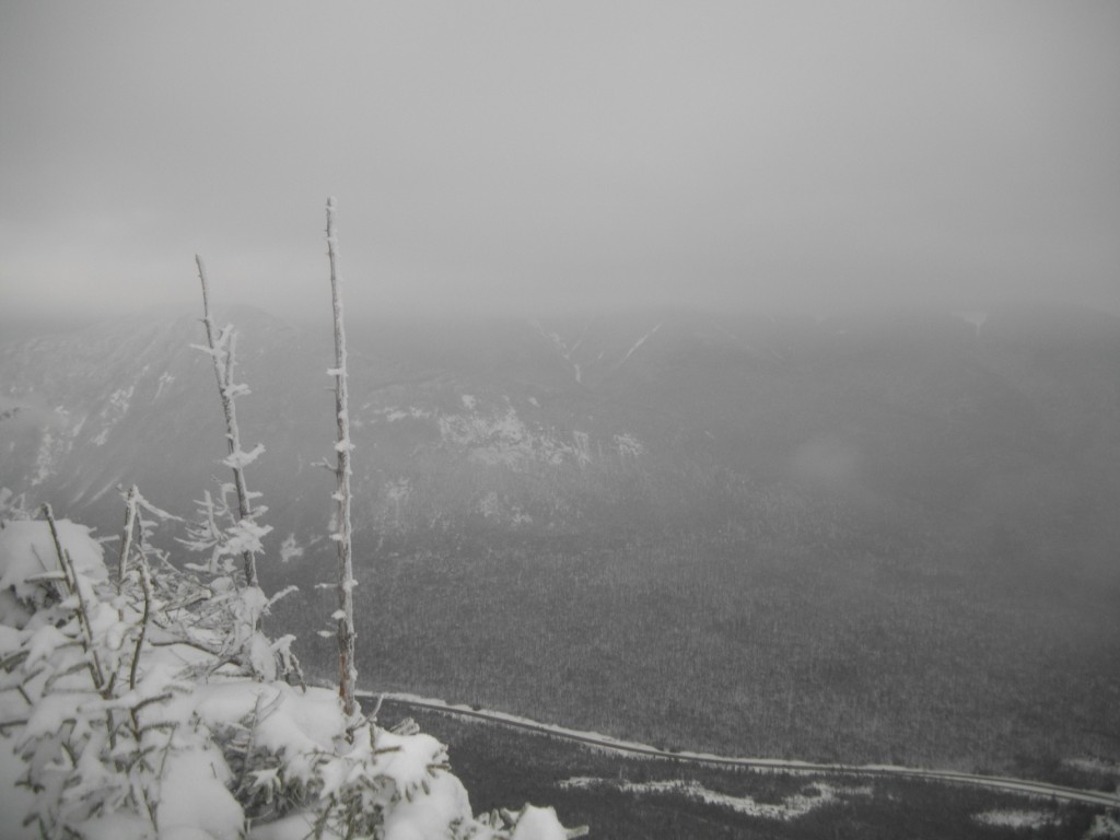
Views going up to N. Kinsman


#7 N. Kinsman


GO BACK TO THE INDEX.  

GO TO THE NEXT HIKE
GO TO THE PREVIOUS HIKE

Friday, January 6, 2012

#6 Cannon, (4100') January 6, 2012

\# 6: 01/06/2012 (Saturday)  Cannon Mt.  (4100 AMC # 36)

5.9 miles,  2330 ft elevation gain,  5:21 Book time.  My time 7:00 hrs;   ratio = 1.30,  09:15 (late start)  – 16:15 still daylight).  Planned to do the two Kinsmans but on the drive up I realized I left my jacket and cell phone home and had to turn around and start over - lost ~ 1-2 hours.  Cannon was my backup but I didn’t commit until part way into the hike (I never would have made both Kinsmans before dark).  Besides the turnaround I almost had a bad accident driving up in the snow.  I did a 180 in front of a plow and ended up in a ditch (forgot to weight the back of my pickup) – miraculously there was no damage and I was able to get out with my 4 wheel drive.   Also weather conditions should have told me to delay a day but momentum had already started.  There was light snow with two inches predicted and no views expected.   My plan was to go up Hi-Cannon trail if I was doing Cannon but I missed the hi-cannon cut off (no sign /no tracks). Then at lonesome lake I was going to take the Dodge Cutoff back to Hi-cannon, but there was no visible tracks under the new snow so I followed the lonesome lake trail part way around the lake to see if the trail was broken out all the way up. Two hikers coming from the around the lake trail continued up the trail to Kinsman Ridge, so I stayed on that trail to the ridge then to Cannon.  A 300 – 400 ft (altitude) section of this trail was extremely steep and was the hardest hiking (more like climbing) I’ve had to do yet and I needed to stop every 50 ft of altitude to get my breath back and my heart rate down.  This section was more like climbing then scrambling.  I swapped out my micro spikes for my Hillsounder crampons as it started getting steep and I was losing traction. Other hikers I met at the top also missed the Hi-cannon cutoff and came this way but said the micro-spikes were fine for them.  I dropped my pack at the top connection with Hi-cannon but really didn’t need to since the remaining hike to cannon was gradual.

Met the two hikers mentioned earlier half way along this last section on the rim trail. They had stopped at the lodge near the cannon tramway and sat by the fire for ½ hour (shows how slow I was hiking)  I continue to the peak and the tower and climbed to the top of the tower (which needed traction because the steps were really a solid snow slope. Snapped a few pictures in the fog (sadly there was no views).  I could see the top of one of the chair lifts only 50-100 ft down from the tower. Kind of diminishes the challenge of half killing myself to get to the altitude that skiers can get to in minutes.  There was some wind on the top and it was getting colder and later so I did not spend much time on the top and did not go around the rim to the tramway.   There was really no noticeable wind on this entire hike except right at the top. The complete trail is protected and except right around the tower there is no exposed area. Overall it was the hardest hike I’ve done yet because of that one steep section and it completely drained me.   Still I’m glad I did it and resisted the temptation to turn around and descend half way up that section.  One other note, I was overdressed for the weather and could have gone without the long johns.  I stripped my middle layer vest and hiked most of the way with my jacket opened.
Pictures :


looking across lonesome lake
you can just make out the roof of the AMC hut

This is why I didn't go up th Dodge Cut-Off.


View of a ski lift from the tower.
on top of the tower.

#6 Cannon summit picture - on the tower.

on the way down hi-cannon, there were a few open areas for views
but it was still hazzy.

View of Rt 93


Ladder going down Hi-Cannon.
(could have used some ladders coming up the back way on the ridge.)

Last picture - 
I think it was snowing after this with little visability.

GO BACK TO THE INDEX.  
>
GO TO THE NEXT HIKE
GO TO THE PREVIOUS HIKE