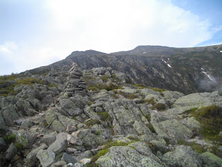
05/25/2012 (Friday) . From Appalachia Trail Head, up Air Line to Madison to Madison Hut via Gulfway Down via Valley Way, Lower Bruin, Brookside, Valley Way, Fallsway to Tama Falls, to Valley,, to App Th. Per amc online: 9.1 miles, elevation gain; 4660’, max el change 4473. Book time 6:54. My actual time ~ 11:30 ratio to book 1.64 – not sure why. Drove up to TH the night before and slept at TH ~12-4:30. Started at 5 am. Forecast was windy and 30% chance of showers. Plan was to change to a lower mountain (Tom, Field, Wiley) if it didn’t look good at the start. At 5am it was clear and promising to be good weather day. Plan was also to do both Adams and Madison with possible bailout to just Madison once I got to the Air Line Cutoff. Hike up to the alpine area was uneventful with a few scrabbles but nothing too difficult. Once in the alpine area Madison and Adams were in the clear and there was a low hanging cloud cover below in the valleys. I still thought I might do both summits and headed toward Adams, at first I thought (or actually was hoping) what was actually Mt Quincy Adams was Mt Adams and what was actually Mt Adams might be Jefferson even though I could easily see that the first peak was lower than Mt Madison. At this point I could also see Madison Hut in the Col between the Quincy and Madison. The trail from this point is really just a series of Cairns heading toward the peak along the upper part of Adams which, just like Jefferson , is really just a huge pile of rocks and boulders. The summit is pretty anticlimactic and just a trail sign at the very peak which has no level area near it. The low hanging clouds caught up to me just as I reached the peak and as I looked around I had no visibility of any of the other peaks. Just as I was phoning Deb and ready to take a planned 15 minute break, it started to rain. Not hard, but threatening enough so that I decided to head straight down to the Hut. This when I first found that a slight coat of rain water on top of the lichen encrusted boulders is very slippery. I probably slipped and almost fell half a dozen times before figuring out how to manage them. The last slip and fall was pretty bad and I did a face plant with my chin into a flat surface of a boulder. I did break my fall with my hands but for a brief second I thought I really blew it as felt simultaneous pain in my chin and my left shin. Turns out it wasn’t so bad after all and I didn’t even break skin. What I figured out is that I had to step on the edges, the sharper the better of the boulders. And in this area the rocks are not smooth but jagged so that isn’t that difficult. It is a little harder on the feet and slows you down though. I think this fall and subsequent falls on wet smooth rocks further down the trails might have been the reason I ended up with such a long hike time. Once I got back to where Gulfside meets Airline and heads to the hut I saw my first group of hikers that day. One kid in the group had sprained his ankle. Him and one friend stayed together down to the hut while the others quickly moved ahead. I hate to say it but thier handicapped pace was pretty much my downhill pace and I stayed behind them with little decrease in my rate. The Hut was closed (would open the following week) but there was one caretaker their setting things up. The rain was on & off at that point and the visibility to Madison was on & off. I debated if I should go on to Madison but decided that I would not because there was a good chance that it wouldn’t clear and there would be no views and I really didn’t want to contend with another pile of slippery wet boulders. Heading down the Valley Way I found that I still had a traction problem because the rocks along this trail were also slippery but were smooth with no jagged edges to step on. I probably slipped another 6 times or so. Nothing too bad but very discouraging and potentially dangerous. I started meeting other groups of hikers coming up and after an hour the sun was back out and it stayed cleared. I jumped off Valley Way to the more scenic but probably harder trails to the North along thge border of Snyder brook. That part of the hike was very pleasant with the views and sounds of the brook as it cascaded down small falls adjacent to the trail. All in all this wasn’t one of my better hikes but still worthwhile. I guess it’s the first time I wasn’t lucky with the weather, but still it could have been much worse.
PICTURES: (captions TBD)


PICTURES: (captions TBD)


GO BACK TO THE INDEX.
GO TO THE NEXT HIKE
GO TO THE PREVIOUS HIKE