# 41 & 42 Whiteface & Passaconaway Dec 13, 2012
Whiteface 4005', Passaconaway 4043' 12-13-12:
Trip Stats: 11.7 miles (+0.5 mile road hike), elevation gain: 4400', AMC book time: 8.:01, my time (05:00 - 16:45) = 11:40 - breaks and road hike time = 10:30 on trail.
Ratio to AMC book time = 1.30 (per usual).
Last week I did the most northern NH4k. This week I did the most southern two peaks. This leaves only 6 peaks. This hike will not go on my list of hikes I must do again. The views are not spectacular and 99% of the hike is of moderate grades, not challanging or particularley scenic. The high point of the hike is a short scramble just below the southern peak of Whiteface which is very difficult.
Pictures:
Sun starting to come up @ 6:40 - I started at 05:05
This is at the junction of Blueberry Ledge trail and Blueberry Ledge Cutoff (~2090 ft)
I meant to take the cutoff up but missed it in the dark. It's just starting to get light. I didn't have too much trouble following the trail by head lamp (no moonlight this time). I did get off trail for a while but using my GPS I was able to easily pick it back up.
Interesting blow-over . This large tree growing on the rock face had no roots in the soil to speak of. Its amazing it gew this big before just falling over. Hikers: I had some problem picking the trail back up from this junction on a large rock face. It starts back up right behind this blow-down.
Woodpeckers ?
No water on the trails today. Just ice, but easy to walk around
up until just before the south peak of Whiteface
one of the few view points on the trail up to Whiteface (~2950')
Start of the only difficult part of the hike (~ 3590').
This short section is a very difficult scramble (especially with a heavy pack).
Thankfully there was no ice.
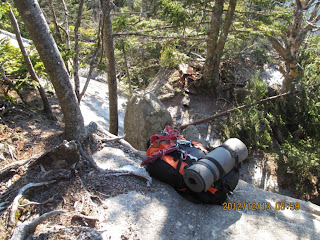
I could not get up this rock face with my pack on. Too much pack weight and excess body weight and too little upper body strength) but --
I was able to toss my pack up to the next ledge then climb up after it.
Looking back down you can see the holes in the rock face were a steel ladder use to be.
I had to repeat this procedure for the second ledge.
If the ledges had been any higher I would have had to tie a line to my pack and pull it up after me.
Looking down from the second ledge.
A good viewing area at the South ledges of Whiteface just after the tough scramble.
#41 The true viewless summit of White face is 0.2 miles north
of the above views after going down and back up out of a small col.
Rollins trail continues north toward Mt Passaconaway.
This area of the trail was destroyed by blow-overs from Sandy.
For over a hundred feet I had to climb through this mess with no sign of the actual trail.
It reminded me of the scenes from Band of Brothers at the Argonne forest when bombs were exploding the trees.
It will take a long time for the AMC volunteers to clear this.
A few small views spots on the way to Passaconaway.
I dropped my pack at this trail junction ( Rollins & Dicey Mill.),
and just took my bug-out bag to do the short loop to Passaconaway.
A short section of Walden trail also had quite a few blow-downs, but it's evident that they are in the process of clearing them
A small viewing area just off of the actual viewless summit.
There is a spur off the north side that is suppose to have better northern views but I was running over schedule and didn't want to go down and back up the 0.3 miles.
short spur to the viewless summit of Passaconaway.
#42 Mt Passaconaway
Easy grades down from Passaconaway along the Dicey Mill trail,
Then; a long - long almost flat hike. I actually made up some time on this section.
Sun just disappearing behind the peaks (15:30)
Only real river crossing on the entire hike.
I was going to walk across this large birch as I've seen others do on their web sites,
but then realised the river was low enough to rock hop.
Back at my truck at 4:45 pm just as it was getting dark. At least it's only a 3.5 hour drive home this time.
GO BACK TO THE INDEX.
GO TO THE NEXT HIKE(The Hancocks)
GO TO THE PREVIOUS HIKE (Cabot)


0 Comments:
Post a Comment
Subscribe to Post Comments [Atom]
<< Home