# 11 Mt Washington (6288’ ) March 22,2012
# 11 Mt Washington (6288’) , March 22, 2012
03/22/2012 (Thursday)
. Up
Ammonoosic trail to the Lake of the Clouds Hut (closed) then up Crawford Path
down Edmond and back the same way. Elevation
gain: 3994’ Book
time: 8:34, My hike time 10:30 hrs; (0730 to 1930 – 1.5 on top), ratio to book: near 1.22 (that good for me). Ammanoosaic is the steepest, and I think the more scenic of the two trails up from the Cog railway side of Washington. The other being Jewel.
The weather was unbelievably warm for
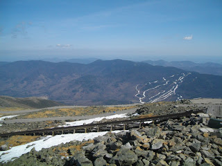
this time of year and there was barely any snow above the Lake of the clouds other than one short snowfield that was still fairly deep. I had dropped my snowshoes at the hut so I post holed my way across the field. Going up from the hut to the summit I could see why its called the rock pile. The upper part of Washington really is only a big pile of rocks and boulders. Some of the trail had water running down it , even on the dry sections you could hear the water running under the rocks from all the melting ice below the surface. Reaching the top was a bit anti climatic. The trail from the hut up is not particularly steep or difficult (though long). The big thing about Washington is it's infamous weather. And, I was hiking up on what could well be the best weather it's ever had in March. It would almost have been a shame if I'd hiked it the day before because it would have counted as a winter hike and it really shouldn't.
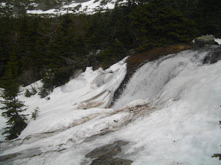
The most significant part of this hike was not the summit but a very tough river crossing going down. Because of all the melting snow and Ice on this extraordinary warm March day, a river that I had easily rock hoped across on the way up had turned into a roaring rapid by the time I returned to it on the way down. There was no way to cross without getting calf deep in the sweeping water On top of that just below the only hopeful place to cross was a steep water fall. If I had tried to wade across and lost my footing I was sure to get swept over the falls. One option would be to backtrack and go down the Jewel trail but that would have added hours to a trip that was already running late. Luckily I had a 25 ft length of webbing with me. I tied one end to a tree a bit up stream of were I wanted to cross and waded across with a firm grip on the other end of the line. ( I guess you could call this a lateral repel) . This worked out with no problem other then getting drenched from the knees down and having to leave the line behind. I felt pretty good about overcoming this obstacle, much more than finally submitting Washington.
The most significant part of this hike was not the summit but a very tough river crossing going down. Because of all the melting snow and Ice on this extraordinary warm March day, a river that I had easily rock hoped across on the way up had turned into a roaring rapid by the time I returned to it on the way down. There was no way to cross without getting calf deep in the sweeping water On top of that just below the only hopeful place to cross was a steep water fall. If I had tried to wade across and lost my footing I was sure to get swept over the falls. One option would be to backtrack and go down the Jewel trail but that would have added hours to a trip that was already running late. Luckily I had a 25 ft length of webbing with me. I tied one end to a tree a bit up stream of were I wanted to cross and waded across with a firm grip on the other end of the line. ( I guess you could call this a lateral repel) . This worked out with no problem other then getting drenched from the knees down and having to leave the line behind. I felt pretty good about overcoming this obstacle, much more than finally submitting Washington.
Pictures:
coming up on lake of clouds hut (close)
first real view of Washington
top of the Cog rails
Small snow field above the hut (see my post hole tracks)
next few pictures are of a very hard river crossing that
was much easier on the way up before the snow started melrting.
Line I tied to a tree to do a lateral repel.
view up steam from thge crossing
frozen falls above the crossing
Steep falls below the crossing
GO BACK TO THE INDEX.
GO TO THE NEXT HIKE
GO TO THE PREVIOUS HIKE


0 Comments:
Post a Comment
Subscribe to Post Comments [Atom]
<< Home